


The underwater volcanic eruption that occurred in the Tonga archipelago (175.4° W; 20.6° S) on January 15, 2022, at 4:15 UT (17:15 LT) generated an enormous amount of energy yielding to the injection of a large amount of matter to the upper atmosphere and have generated Tsunami as shown in Figure 1.
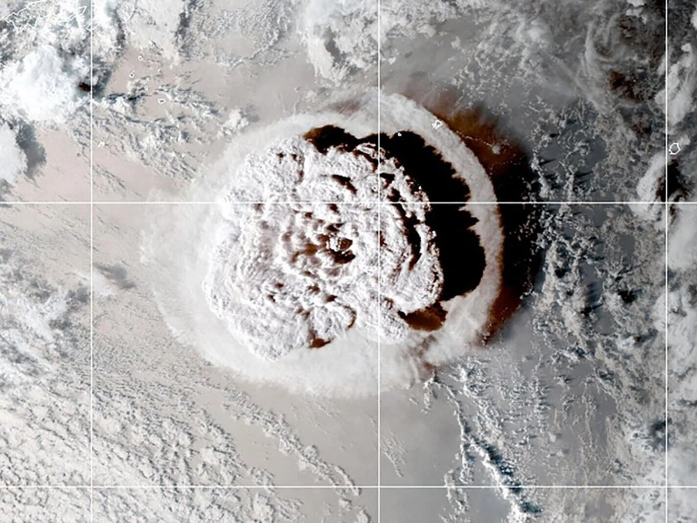
Source: https://www.nesdis.noaa.gov/news/hunga-tonga-hunga-haapai-erupts-again
In the South Pacific Ocean, waves of more than one meter high were observed due to the Tsunami. After 13 hours of the eruption, the tsunami waves reached the southern coast of Chile around 17:00 UT as shown in Figure 2. Figure 2 shows oscillations with the amplitude of almost 1 m, due to the Tsunami measured by the ocean buoy of Bahia Mansa, Chile starting at 17:00 UT. As a consequence, the tsunami caused gravity waves in the local atmosphere that propagated up to 200-300 km in altitude, thus disturbing the ionosphere.
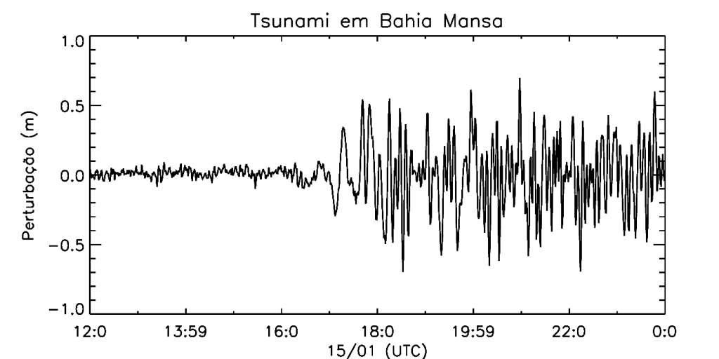
Source: http://www.ioc-sealevelmonitoring.org/station.php?code=bmsa2
Figure 3 Shows the disturbed Total Electronic Content (dTEC) maps over South America for January 15, 2022, at 18:38 UT. Wave structures (red and black regions) are observed over Chile and Argentina propagating in the northeast direction and which also propagated throughout South America.
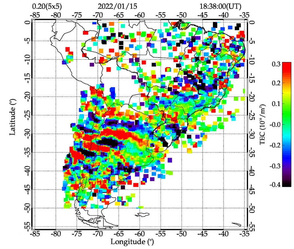
It is worth noting that the disturbed Total Electronic Content data is calculated by Embrace through data from the GNSS receiver network spread over South America.
(Authored: EMBRACE/INPE, 02/21/2022)